
|
| Our subscribers' grade-level estimate for this page: 3rd - 4th |
 Outline Maps |
EnchantedLearning.com World Geography |
 Flags |
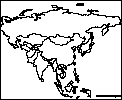
| Africa | Antarctica | Asia | Australia/Oceania | Central America/ Caribbean | Europe | Mideast | North America | South America | USA |
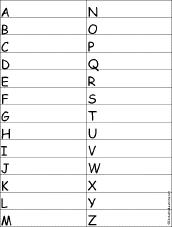
| A | B | C | D | E | F | G | H | I | J | K | L | M | N | O | P | Q | R | S | T | U | V | W | X | Y | Z |
Miscellaneous Geography Activities
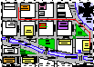 City Map Reading Activity Printout #1 Follow directions and answer questions about a city map. Answers |
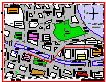 City Map Reading Activity Printout #2 Follow directions and answer questions about a city map. Answers |
 Map Reading Activity Printout #1 Color the map, read compass directions, estimate distance, and read latitude and longitude. Answers |
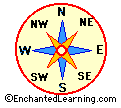 Compass Rose A compass rose is a design on a map that shows directions. Fill in the directions on this compass rose printout. |
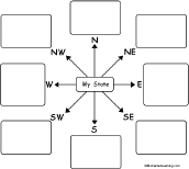 My Own Compass Rose Maps In these printable map activities, the student has to think about where things are located with respect to a familiar place. For each direction in the compass rose (N, NE, E, SE, S, SW, W, NW), the student writes a place that is located in that direction from home, school, town, state, or country. |
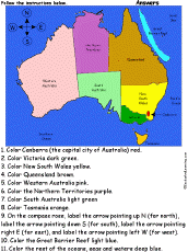 Australia: Follow the Instructions Color Australia according to simple directions, such as, "Color Victoria dark green." Or go to the answers. |
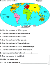 Continents: Follow the Instructions Color the continents according to simple directions, such as, "Color the continent of Africa green." Or go to the answers. |
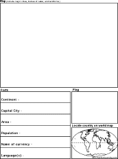 Country Report Graphic Organizer Printout #1 This printout helps the student do a short report on a country, prompting the student to draw a map of the country, locate it on a world map, draw the country's flag, and write the country's continent, capital city, area, population, name of currency, and language(s). |
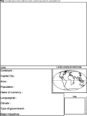 Country Report Graphic Organizer Printout #2 This printout helps the student do a short report on a country, prompting the student to draw a map of the country, locate it on a world map, draw the country's flag, and write the country's continent, capital city, area, population, name of currency, language(s), climate, type of government, and major industries. |
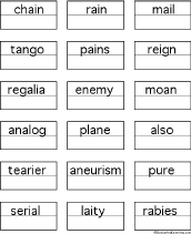
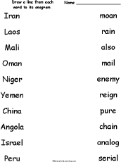 Match the Country Name Anagrams Draw a line from each country name to its anagram. Words: Iran/rain, Laos/also, Mali/mail, Oman/moan, Niger/reign, Yemen/enemy, China/chain, Angola/analog, Israel/serial, Peru/pure. Or go to the answers. |
 Country Name Anagram Puzzle Worksheet On this printable worksheet, the student writes a country name for each anagram. Or go to the answers |
Nepal panel penal plane Country Anagrams A web page with the names of many countries that are anagrams. Some examples include: China/chain, Mail/mail, Niger/reign, Peru/pure, Spain/pains, Tonga/tango. |
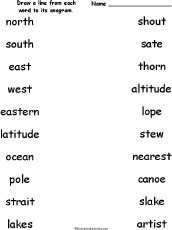 Match the Geography Anagrams Draw a line from each geography-related word to its anagram. Words: north/thorn, south/shout, east/sate, west/stew, eastern/nearest, latitude/altitude, ocean/canoe, pole/lope, strait/artist, lakes/slake. Or go to the answers. |
 Geography Anagram Puzzle Worksheet On this printable worksheet, the student writes a geography anagram for each word. Or go to the answers |
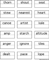
eastern earnest nearest plane Geography Anagrams A web page with geography terms that are anagrams. Some examples include: latitude/altitude, nation/anoint, region/ignore. |
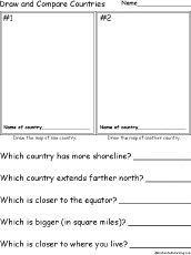 Draw and Compare Countries Draw two countries, and then answer simple questions comparing them, for example, "Which country extends farther north?" |
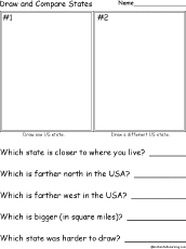 Draw and Compare US States Draw two US states, and then answer simple questions comparing them, for example, "Which state is farther west in the USA?" |
 Find a Geography Word for Each Letter See if you can think of and write down a place name that starts with each letter of the alphabet. Or go to a sample answer page. |
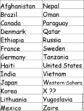 Find a Country for Each Letter See if you can think of and write down a country name for each letter of the alphabet. Or go to a sample answer page. |
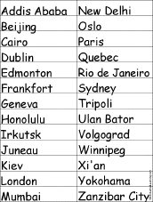 Find a City for Each Letter See if you can think of and write down a city name for each letter of the alphabet. Or go to a sample answer page. |
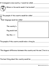 Design A New Country A Worksheet to Print A short, printable worksheet with prompts for short answers to questions about a new country you design. Go to a pdf version of the worksheet. |
Johnny Appleseed Geography Quiz - Labeled Map Take a US geography quiz based on Johnny Appleseed's life using a map labeled with each state's abbreviation. Or go to the answers. |
Johnny Appleseed Geography Quiz - Unlabeled Map Take a US geography quiz based on Johnny Appleseed's life using an unlabeled map. Or go to the answers. |
 Landforms Label the archipelago, bay, gulf, island, isthmus, peninsula, river, lake, and strait. Answers |
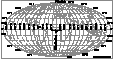
 Latitude and Longitude Label the latitudes and longitudes on the world map. Answers |
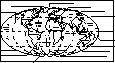
 Latitude and Longitude of the World: Outline Map Printout An outline map of world latitudes and longitudes to print. |
 Latitude and Longitude of the World (Cylindrical Projection): Outline Map Printout: An outline map of world latitudes and longitudes to print (a cylindrical projection - it has straight lines of latitudes and longitude, but the areas near the poles are exaggerated in size). |
World Latitude and Longitude Activity (A Printout) Plot longitudes and latitudes on the world map. Or go to the answers. |
 USA Latitude and Longitude Activity Printout #1 Answer questions about latitude and longitude. Answers |
USA Latitude and Longitude Activity Printout #2 Answer questions about latitude and longitude. Answers |
 Map Quiz Worksheets On each printable worksheet, the student reads a map to answer geography questions. |
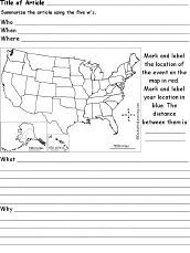 News Article 5 W's Analysis Worksheet - US Summarize a US new article using this graphic organizer, noting the 5 w's, who, when, where, what, and why. Map the location of the news event and your location. |
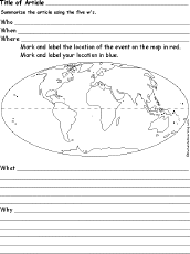 News Article 5 W's Analysis Worksheet - World Summarize a world new article using this graphic organizer, noting the 5 w's, who, when, where, what, and why. Map the location of the news event and your location. |
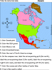 North America: Follow the Instructions Draw and color North America according to simple directions, such as, "Color the USA green." Or go to the answers. |
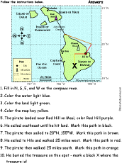 Pirate Map: Follow the Instructions Color a pirate map according to simple directions, such as, "The pirate then walked 25 miles south. Mark this path in orange." Or go to the answers. |
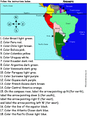 South America: Follow the Instructions Color South America according to simple directions, such as, "Color Peru red." Or go to the answers. |
World Latitude and Longitude Activity (A Printout) Plot longitudes and latitudes on the world map. Or go to the answers. |
 Topographic Map Reading Activity Printout #1 Color the elevations of the topographic map, then answer questions about the map. Answers |
 Topographic Map Reading Activity Printout #2 Color the elevations of the topographic map, interpret the map and answer questions. Answers |
Tracking a Hurricane Practice tracking a hurricane using this printout. Or go to the answers. |
Tracking a Real Hurricane Track a real hurricane using this printout. Get a hurricane's locations from the National Hurricane center. |
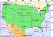
 USA Map: Find Your State Find and label your state in the USA, and label other important geography. Answers |
USA Map: Where I Live Write your country, state, and city, and then find and label your state (and a few other geographical features). |
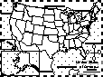
 US State Report Graphic Organizer Printout #1 This printout helps the student do a short report on a US state, prompting the student to draw a map of the state, locate it on a world map, draw the state's flag, and write its, capital city, state nickname, area, population, date of statehood, and state bird. |
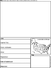
 US State Report Graphic Organizer Printout #2 This printout helps the student do a short report on a US state, prompting the student to draw a map of the state, locate it on a world map, draw the state's flag, and write its, capital city, state nickname, area, population, date of statehood, state bird, state flower, climate, and major industries. |
 Geography Quiz A Worksheet to Print A short, printable worksheet quiz about world geography. The short-answer worksheet asks 15 general questions about the earth's continents and oceans, for example, On which continent do you live? Or go to the answers. |
 Where I Live (Asia) A short activity book on geography to print for early readers. There are pages on the Solar System, the continents, Asia, and the student's home. |
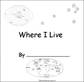 Where I Live (Australia) A short activity book on geography to print for early readers. There are pages on the Solar System, the continents, Australia (states and territories), and the student's address. |
 Where I Live (Europe) A short activity book on geography to print for early readers. There are pages on the Solar System, the continents, Europe, and the student's home. |
 Where I Live (UK) A short activity book on geography to print for early readers. There are pages on the Solar System, the continents, Europe, the UK, and the student's home. |
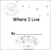 Where I Live (USA and Canada) A short activity book on geography to print for early readers. There are pages on the Solar System, the continents, North America, and Canada or the USA. |
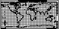
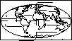 World Map: Where I Live Answer questions about where you live and label the world map. Answers |
 Geography: Write a Question for Each Answer In these worksheet, the student is given a series of short answers using geograph terms, including continents, oceans, seas, countries, and others. For each answer, the student writes a short question. |
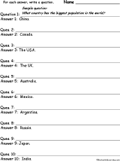
Countries #1: Write a Question for Each Answer In this worksheet, the student is given a series of short answers using country names. For each answer, the student writes a short question. Countries: China, Canada, the USA, the UK, Australia, Mexico, Argentina, Russia, Japan, India. |
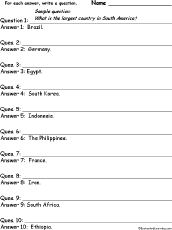 Countries #2: Write a Question for Each Answer In this worksheet, the student is given a series of short answers using country names. For each answer, the student writes a short question. Countries: Brazil, Germany, Egypt, South Korea, Indonesia, the Philippines, France, Iran, South Africa, Ethiopia. |
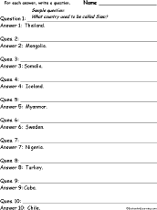 Countries #3: Write a Question for Each Answer In this worksheet, the student is given a series of short answers using country names. For each answer, the student writes a short question. Countries: Thailand, Mongolia, Somalia, Iceland, Myanmar, Sweden, Nigeria, Turkey, Cuba, Chile. |
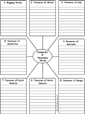
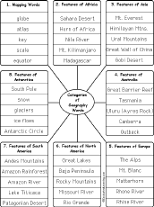 Write Geography Words by Category Write geography words by category (write 5 words per category). The categories include: Mapping Words, Features of Africa, Features of Asia, Features of Australia, Features of Europe, Features of North America, Features of South America, Features of Antarctica. Or go to sample answers. |
 Write Geography Words by Category Write 10 geography words for each category. The categories include: Mapping Words, Features of Africa, Features of Asia, Features of Australia, Features of Europe, Features of North America, Features of South America, Features of Antarctica. Or go to sample answers. |
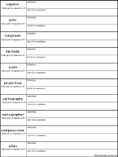 Write Map-Related Definitions In this worksheet, write the definition of a word, what part of speech it is, and use it in a sentence. Words: equator, pole, longitude, latitude, scale, projection, cartography, cartographer, compass rose, atlas. Or go to the answers. Or go to a pdf of the questions and answers (subscribers only). |
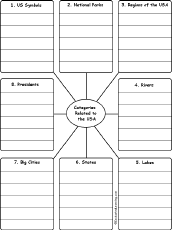 Write USA-Related Words by Category Write 5 USA-Related words for each category. The categories include: US Symbols, National Parks, Regions of the USA, Rivers, Lakes, States, Big Cities, Presidents. Or go to sample answers. |
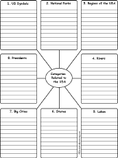 Write USA-Related Words by Category Write 10 USA-Related words for each category. The categories include: US Symbols, National Parks, Regions of the USA, Rivers, Lakes, States, Big Cities, Presidents. Or go to sample answers. |
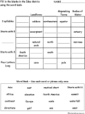 Idea Matrix Puzzle: Geography Words In this sorting and classifying activity, the student fills in the blanks (and some categories) in an idea matrix using a word bank. Classify and sort the words by category and word structure. Word bank: Asia, Africa, continent, directions, east, elevation, Europe, gulf, nautical chart, North America, scale, sea, Stars with N, summit, waterfall, west. Or go to the answers. Or go to a pdf of the puzzle and the answers. |
Enchanted Learning®
Over 35,000 Web Pages
Sample Pages for Prospective Subscribers, or click below
|
Overview of Site What's New Enchanted Learning Home Monthly Activity Calendar Books to Print Site Index K-3 Crafts K-3 Themes Little Explorers Picture dictionary PreK/K Activities Rebus Rhymes Stories Writing Cloze Activities Essay Topics Newspaper Writing Activities Parts of Speech Fiction The Test of Time
|
Biology Animal Printouts Biology Label Printouts Biomes Birds Butterflies Dinosaurs Food Chain Human Anatomy Mammals Plants Rainforests Sharks Whales Physical Sciences: K-12 Astronomy The Earth Geology Hurricanes Landforms Oceans Tsunami Volcano |
Languages Dutch French German Italian Japanese (Romaji) Portuguese Spanish Swedish Geography/History Explorers Flags Geography Inventors US History Other Topics Art and Artists Calendars College Finder Crafts Graphic Organizers Label Me! Printouts Math Music Word Wheels |
Click to read our Privacy Policy
| Search the Enchanted Learning website for: |