
|
| Our subscribers' grade-level estimate for this page: 4th - 5th |
 Outline Maps |
EnchantedLearning.com World Geography |
 Flags |
| Africa | Antarctica | Asia | Australia/Oceania | Central America/ Caribbean | Europe | Mideast | North America | South America | USA |
| A | B | C | D | E | F | G | H | I | J | K | L | M | N | O | P | Q | R | S | T | U | V | W | X | Y | Z |
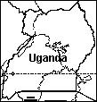 Uganda An outline map of Uganda to print. Or go to printable worksheets that require research (using an atlas or other geography reference): a simple map research activity, a medium-level map research activity, or an advanced map research activity. |
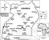 Uganda: Map Quiz Worksheet A printable quiz on the major geographic features of Uganda. The student reads a map to answer 10 geography questions. Or go to the answers. |
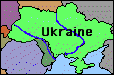 Ukraine Geography, maps, the flag, quizzes, and printouts on Ukraine. |
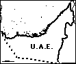 United Arab Emirates: Outline Map Printout An outline map of U.A.E. to print. Or go to printable activities that require research (using an atlas or other geography reference): a simple map research activity, a medium-level map research activity, or an advanced map research activity. |
 The United Kingdom Geography, maps, the flag, and printouts on the UK. |
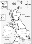 UK: Map Quiz Printout Take a quiz on the map of the United Kingdom of Great Britain and Northern Ireland. Or go to the answers. |
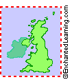
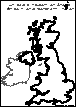 UK: Outline Map Printout An outline map of UK to print. Or go to printable worksheets that require research (using an atlas or other geography reference): a simple map research activity, a medium-level map research activity, or an advanced map research activity. |
 UK: Zoom School Learn about the geography, of the United Kingdom of Britain and Northern Ireland. |
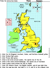 United Kingdom of Great Britain and Northern Ireland: Follow the Instructions Color the United Kingdom of Great Britain and Northern Ireland according to simple directions, such as, "Draw a red circle around Edinburgh, the capital city of Scotland." Or go to the answers. |
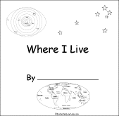 UK: Where I Live A short activity book on geography to print for early readers. There are pages on the Solar System, the continents, Europe, the UK, and the student's home. |
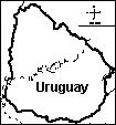 Uruguay: Outline Map Printout An outline map of Uruguay to print. Or go to printable worksheets that require research (using an atlas or other geography reference): a simple map research activity, a medium-level map research activity, or an advanced map research activity. |
 USA GEOGRAPHY PAGES Information, maps, printouts, quizzes, etc. |
USA: Label Me! Printouts Label many maps of the USA. |
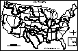
 USA: Outline Map Printouts Outline maps of the USA and US states to print. |
 United States of America: Zoom School Use a pictorial interface to get information on the USA, including maps, flags, animals, explorers, fossils, a quiz, and printouts on the USA. |
USA Map: Label the States Label the 50 US states on the map. Answers |
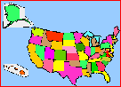
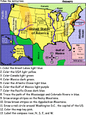 United States of America: Follow the Instructions Color the USA according to simple directions, such as, "Draw orange stripes on the Rocky Mountains." Or go to the answers. |
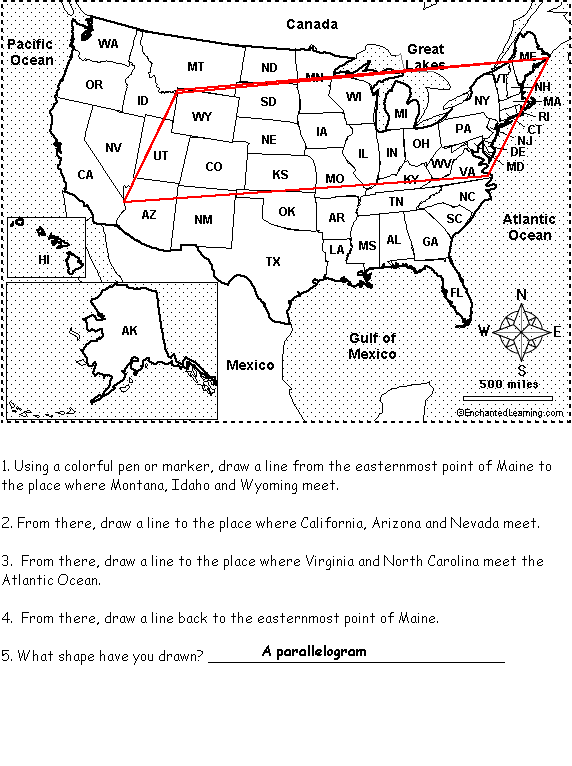 United States of America: Follow the Instructions #2 Draw lines on the USA map according to simple directions, such as, "Draw a line back to the easternmost point of Maine." Or go to the answers. Or go to a pdf of the worksheet and the answers. |
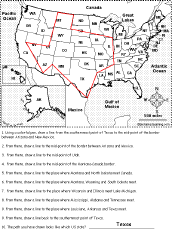
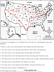 United States of America: Follow the Instructions #3 Draw lines on the USA map according to simple directions, such as, "From D.C., draw a line to the place where Iowa, Nebraska and South Dakota meet." Or go to the answers. Or go to a pdf of the worksheet and the answers. |
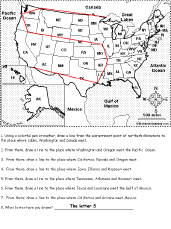 United States of America: Follow the Instructions #4 Draw lines on the USA map according to simple directions, such as, "From there, draw a line to the place where Washington and Oregon meet the Pacific Ocean." Or go to the answers. Or go to a pdf of the worksheet and the answers. |
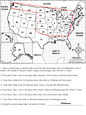 United States of America: Follow the Instructions #5 Draw lines on the USA map according to simple directions, such as, "Draw a line to the place where New York and Vermont meet Canada." Or go to the answers. Or go to a pdf of the worksheet and the answers. |
 United States of America: Follow the Instructions #6 Draw lines on the USA map according to simple directions, such as, "... draw a line to the center of Utah." Or go to the answers. Or go to a pdf of the worksheet and the answers. |
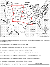 United States of America: Follow the Instructions #7 Draw lines on the USA map according to simple directions, such as, "Draw a line back to the center of North Dakota." Or go to the answers. Or go to a pdf of the worksheet and the answers. |
USA State Facts, Maps, and Symbols A page on each US state listing facts, map and symbols (each one with links to map and flag printouts/quizzes). |
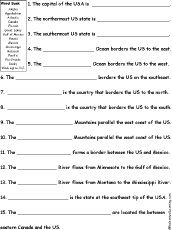 US Geography Quiz A Worksheet to Print A short, printable worksheet quiz about US geography. The short-answer worksheet asks 15 general questions about US geography, for example, "The northernmost US state is _____?" Or go to the answers. |
US Regions: Map/Quiz Printouts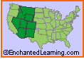 Over 50 map printouts: read a map and answer questions about it. |
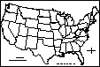
 USA (with state borders): Outline Map Printout An outline map of the USA to print - state boundaries marked. |
USA (Contiguous, with state borders): Outline Map Printout An outline map of the contiguous USA to print - state boundaries marked. |
 USA: Outline Map and Outline Map Research Worksheets An outline map of the United States of America to print. Or go to printable worksheets that require research (using an atlas or other geography reference): a simple map research activity, a medium-level map research activity, or an advanced map research activity. |
 USA (no state borders): Outline Map Printout An outline map of the contiguous USA to print - no state boundaries marked. |
 USA (with state borders and states numbered): Outline Map Printout An outline map of the US states to print - state boundaries marked and the state are numbered (in order of statehood). You can use this map to have students list the 50 US states (answers), the state capitals (answers), or both states and capitals (answers). Or go to a printable page with 50 answer blanks (for your own questions), click here. |
 USA Map: Find Your State Find and label your state in the USA, and label other important geography. Answers |
USA Map: Where I Live Write your country, state, and city, and then find and label your state (and a few other geographical features). |
USA: Shape Poem 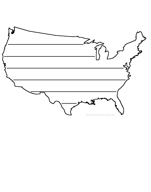 Write a poem inside the map of the USA. Or go to a pdf of the poem worksheet. |
USA: Perimeter Poem 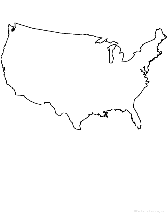 Write a poem around the perimeter (outer edges) of the map of the contiguous US states. Or go to a pdf of the poem worksheet. |
US State Flags: Coloring/Quiz Printouts Color US state flags and answer questions about them. |
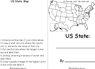 US State Printable Book A short, printable book on a US state. To complete the book, the student must research a US state, draw its map, draw its flag, and answer simple questions about the state. |
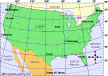
 Color and Count the US States #1: Follow the Instructions Color and count the continental US States according to simple directions, such as, "How many continental US states border the Pacific Ocean? Name them." Or go to the answers. |
 Color and Count the US States #2: Follow the Instructions Color and count the continental US States according to simple directions, such as, "How many continental US states border Mexico? Name them." Or go to the answers. |
 Color and Count the US States #3: Follow the Instructions Color and count the continental US States according to simple directions, such as, "How many continental US states start with the word "New"? Name them." Or go to the answers. |
USA Map: Label the States Label the 50 US states on the map. Answers |
USA Map: Label the State Capitals Label the US state capitals on the map. Answers |
 US Cities: Label Me! Printout Label major cities of the USA. Or go to the answers. |
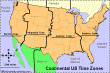 USA Map: Label the Time Zones Label the continental US time zones. Answers |
 USA: Your State Draw and Write Draw a map of the state that you live in (in the USA) and write about it. |
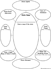 US State Graphic Organizer For one US state, write the name of the state, draw a map of the state and answer simple questions about the state. Sample answers: California, Sacramento (Capital), CA (postal abbrev.), 1850 (date of statehood), Cal. valley quail (state bird), golden poppy (state flower), Sacramento River(a major body of water), Arizona, Nevada (2 bordering states), Golden State (nickname). |
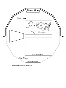 US State Wheel This 2-page print-out makes a wheel about a single US state; the student fills out the information on the wheel. It consists of a base page together with a rear wheel that spins around. After putting the wheel together, the student follows the instructions on the front wheel (coloring in the state on a US map and drawing a small map of the state) and fills out the 12 sections of the wheel with information about one state. When you spin the wheel, facts about the US State appear, including: Biggest Cities, Capital, Flag, Bodies of Water, Postal Abbreviation, State Bird, Population (rank), Area (rank), Residents Called, Bordered by, Major Industries, and Entered Union (order). |
 US State - Find Related Words For a US state, write eight words related to the state, then use each word in a sentence. |
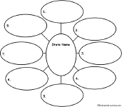
 US State - Find a Related Word for Each Letter See if you can think of and write down a word or phrase for each letter of the alphabet that is related to a US state. Think of cities, famous people from the state, bodies of water, mountains, landmarks, and other features. Find words for as many letters as you can. |
 USA Latitude and Longitude Activity Printout #1 Answer questions about latitude and longitude. Answers |
USA Latitude and Longitude Activity Printout #2 Answer questions about latitude and longitude. Answers |
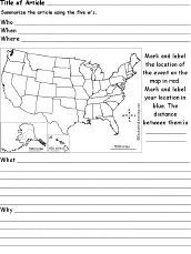 US News Article 5 W's Analysis Worksheet Summarize a US new article using this graphic organizer, noting the 5 w's, who, when, where, what, and why. Map the location of the news event and your location. |
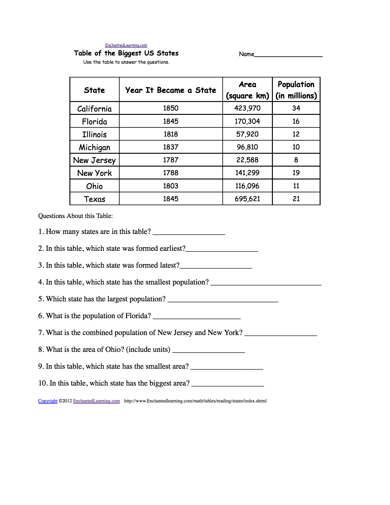 US States: Reading and Understanding Tables Use the table to answer the questions about the biggest US states. Or go to the answers. Or go to a pdf of the quiz and the answers (site members only). |
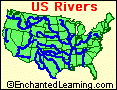 US Rivers A page on US rivers with a glossary of river terms. |
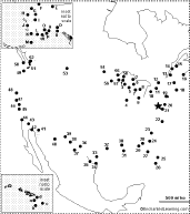
 US Rivers: Outline Map Printout An outline map of the contiguous USA with rivers marked - state boundaries also marked (printable). |
US Rivers Labeled: Outline Map Printout An outline map of the contiguous USA with rivers marked and labeled - state boundaries also marked (printable). |
 USA: Dot to Dot Mystery Map Connect the dots to draw the borders of a mystery country. Then use a globe or atlas to figure out which country you have drawn. You might want to give students clues, such as the continent the country is in (North America), that it is in the Northern Hemisphere, or that its name starts with "U." Answer: United States of America. |
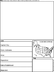 US State Report Graphic Organizer Printout #1 This printout helps the student do a short report on a US state, prompting the student to draw a map of the state, locate it on a US map, draw the state's flag, and write its capital city, state nickname, area, population, date of statehood, and state bird. |
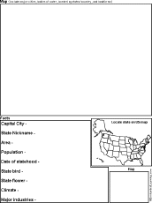 US State Report Graphic Organizer Printout #2 This printout helps the student do a short report on a US state, prompting the student to draw a map of the state, locate it on a US map, draw the state's flag, and write its capital city, state nickname, area, population, date of statehood, state bird, state flower, climate, and major industries. |
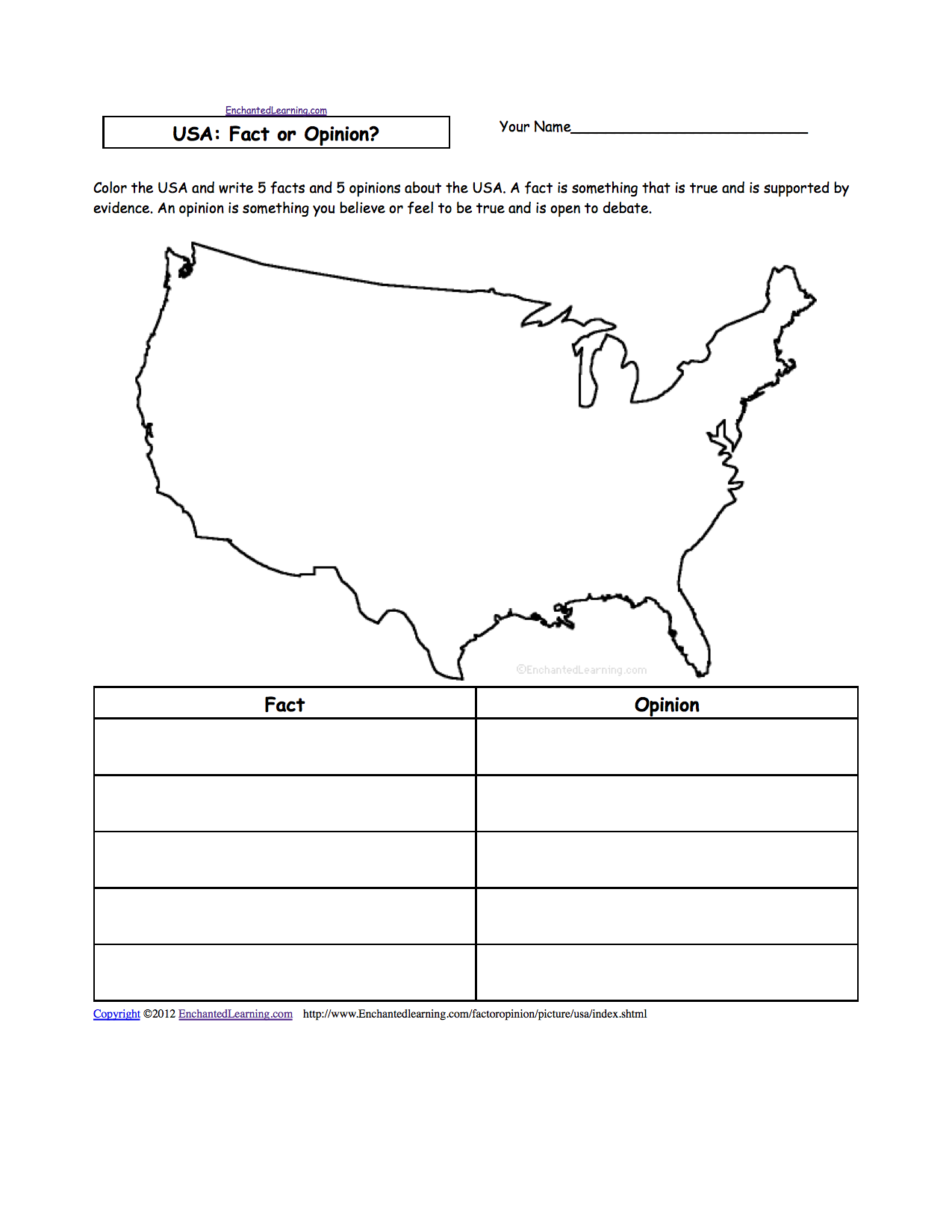 USA: Fact or Opinion? Color the picture of the USA, then write 5 facts and 5 opinions about the USA. A fact is supported by evidence and can be proven; an opinion is how you feel about something and is open to debate. Or go to a pdf of the worksheet (subscribers only). |
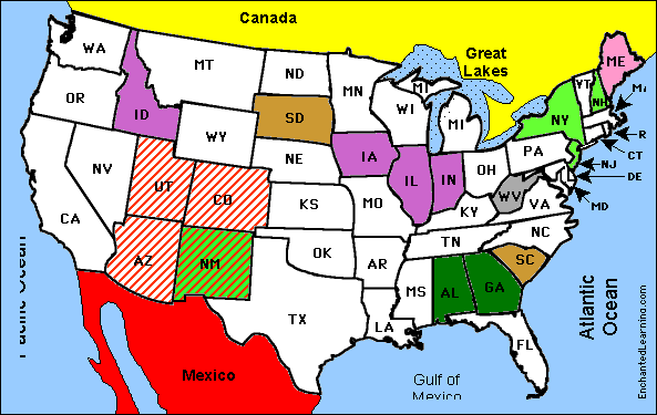
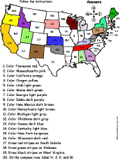
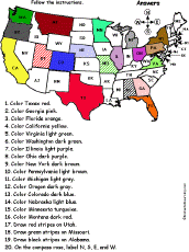 US States Map #1A: Follow the Instructions Color states on a map of the contiguous US according to the directions, such as, "Color Texas red." The states are labeled with their abbreviations. States: Texas, Georgia, Florida, California, Virginia, Washington, Illinois, Ohio, New York, Pennsylvania, Michigan, Oregon, Colorado, Nebraska, Montana, Utah, Missouri, Alabama. Or go to the answers. |
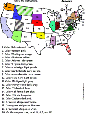
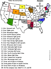 US States Map #2A: Follow the Instructions Color states on a map of the contiguous US according to the directions, such as, "Color Arizona dark green." The states are labeled with their abbreviations. States: Vermont, Idaho, Wyoming, North Dakota, Delaware, Arizona, New Jersey, New Hampshire, Wisconsin, Nebraska, Tennessee, Louisiana, North Carolina, Maine, Connecticut, Mississippi, Arkansas, South Carolina, Oklahoma. Or go to the answers. |
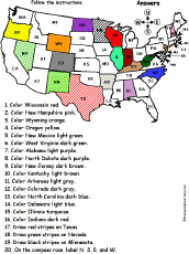
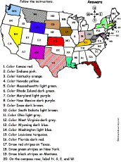 US States Map #3A: Follow the Instructions Color states on a map of the contiguous US according to the directions, such as, "Draw green stripes on New York." The states are labeled with their abbreviations. States: Kansas, Indiana, Kentucky, Nevada, Massachusetts, Rhode Island, Maryland, New Mexico, Iowa, South Dakota, Ohio, West Virginia, Wyoming, Washington, Louisiana, Florida, Texas, New York, Montana. Or go to the answers. |
 US States Map #4A: Follow the Instructions Color states on a map of the contiguous US according to the directions, such as, "Draw green stripes on New York." The states are labeled with their abbreviations. States: Tennessee, Massachusetts, California, Oregon, Utah, Maine, Georgia, Idaho, New Mexico, Pennsylvania, Michigan, Oklahoma, Kansas, Kentucky, New York, Wisconsin, South Dakota, Alabama, West Virginia. Or go to the answers. |
 US States Map #5A: Follow the Instructions Color states on a map of the contiguous US according to the directions, such as, "Color Washington orange." The states are labeled with their abbreviations. States: Washington, Arizona, Virginia, Mississippi, South Dakota, Massachusetts, New York, Michigan, Pennsylvania, Idaho, California, Illinois, Indiana, Florida, Montana, Utah. Or go to the answers. |
 US States Map #6A: Follow the Instructions Color states on a map of the contiguous US according to the directions, such as, "Color Wisonsin red." The states are labeled with their abbreviations. States: Wisconsin, New Hampshire, Wyoming, Oregon, New Mexico, West Virginia, Alabama, North Dakota, New Jersey, Kentucky, Arkansas, Colorado, North Carolina, Delaware, Illinois, Indiana, Texas, Nevada, Minnesota. Or go to the answers. |
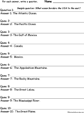 US Geography: Write a Question for Each Answer In this worksheet, the student is given a series of short answers about US geography. For each answer, the student writes a short question. Answers: Atlantic Ocean, Pacific Ocean, The Gulf of Mexico, Canada, Mexico, Appalachian Mountains, Rocky Mountains, Great Lakes, Mississippi River, The Great Plains. |
 US States #1: Write a Question for Each Answer In this worksheet, the student is given a series of short answers using US states. For each answer, the student writes a short question. Answers: Florida, California, Massachusetts, New York, Pennsylvania, Illinois, Texas, Ohio, Hawaii, Alaska. |
 US States #2: Write a Question for Each Answer In this worksheet, the student is given a series of short answers using US states. For each answer, the student writes a short question. Answers: Michigan, Georgia, Virginia, Indiana, North Carolina, Washington, New Jersey, Tennessee, Missouri, Wisconsin. |
 US States #3: Write a Question for Each Answer In this worksheet, the student is given a series of short answers using US states. For each answer, the student writes a short question. Answers: Maryland, Arizona, Minnesota, Louisiana, Alabama, Colorado, Kentucky, South Carolina, Oklahoma, Oregon. |
 US States #4: Write a Question for Each Answer In this worksheet, the student is given a series of short answers using US states. For each answer, the student writes a short question. Answers: Utah, Iowa, Mississippi, Kansas, Arkansas, Connecticut, Nevada, New Mexico, West Virginia, Nebraska. |
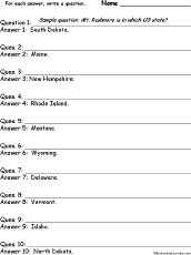 US States #5: Write a Question for Each Answer In this worksheet, the student is given a series of short answers using US states. For each answer, the student writes a short question. Answers: South Dakota, Maine, New Hampshire, Rhode Island, Montana, Wyoming, Delaware, Vermont, Idaho, North Dakota. |
Adjectives Describing the USA 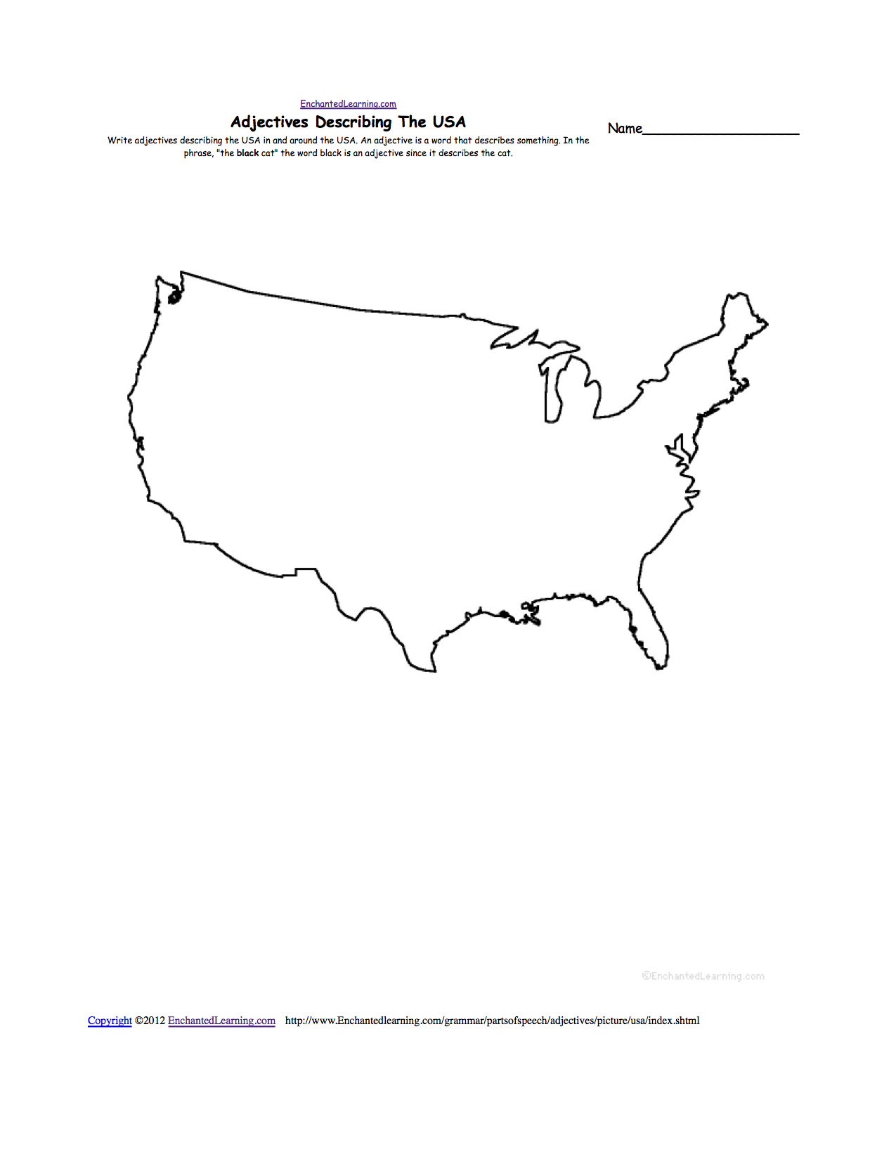 Write adjectives describing the USA in and around the USA. Or go to a pdf of the worksheet. |
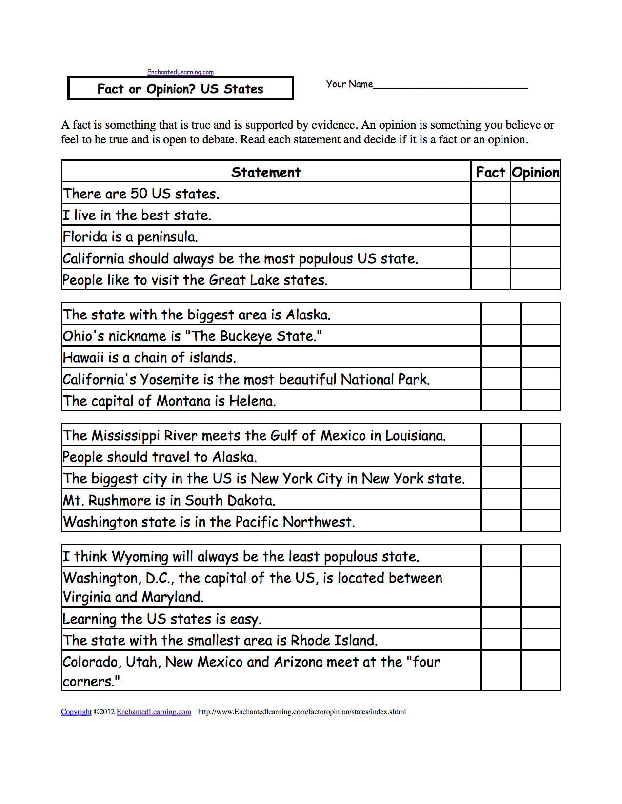 Fact or Opinion? US States Determine if the statements are facts or opinions. A fact is supported by evidence and can be proven; an opinion is how you feel about something and is open to debate. Or go to the answers. Or go to a pdf of the worksheet and answers (subscribers only). |
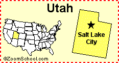 Utah Utah is a state in the western United States of America. Its capital is Salt Lake City. Map, flag, symbols, printouts, and quizzes. |
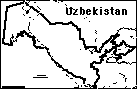 Uzbekistan: Outline Map Printout An outline map of Uzbekistan to print. |
| EnchantedLearning.com World Geography |
Flags |
| Africa | Antarctica | Asia | Australia/Oceania | Central America/ Caribbean | Europe | Mideast | North America | South America | USA |
| A | B | C | D | E | F | G | H | I | J | K | L | M | N | O | P | Q | R | S | T | U | V | W | X | Y | Z |
Enchanted Learning®
Over 35,000 Web Pages
Sample Pages for Prospective Subscribers, or click below
|
Overview of Site What's New Enchanted Learning Home Monthly Activity Calendar Books to Print Site Index K-3 Crafts K-3 Themes Little Explorers Picture dictionary PreK/K Activities Rebus Rhymes Stories Writing Cloze Activities Essay Topics Newspaper Writing Activities Parts of Speech Fiction The Test of Time
|
Biology Animal Printouts Biology Label Printouts Biomes Birds Butterflies Dinosaurs Food Chain Human Anatomy Mammals Plants Rainforests Sharks Whales Physical Sciences: K-12 Astronomy The Earth Geology Hurricanes Landforms Oceans Tsunami Volcano |
Languages Dutch French German Italian Japanese (Romaji) Portuguese Spanish Swedish Geography/History Explorers Flags Geography Inventors US History Other Topics Art and Artists Calendars College Finder Crafts Graphic Organizers Label Me! Printouts Math Music Word Wheels |
Click to read our Privacy Policy
| Search the Enchanted Learning website for: |
Copyright ©2002-2018 EnchantedLearning.com ------ How to cite a web page